In under 72 hours, a fleet of 48 AI agents identified a hidden Maya civic center in the Mexican jungle that had escaped detection by traditional satellite imagery. By processing massive amounts of public NASA lidar data, the agents flagged a site featuring a leveled plaza, an oval pyramid, and a potential water reservoir, leading to a formal inquiry with Mexico's National Institute of Anthropology and History (INAH).
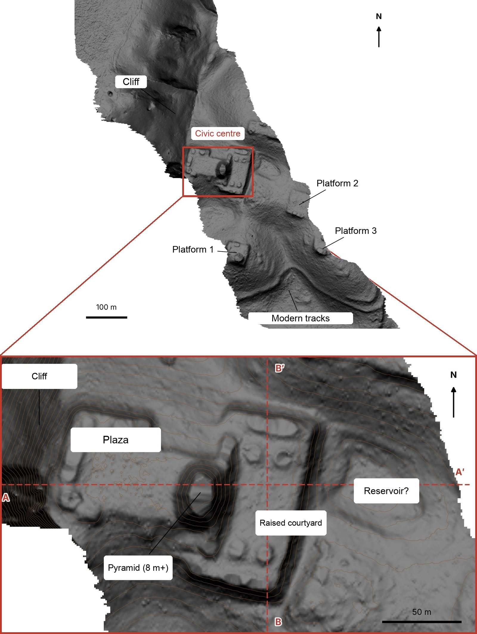
This image illustrates the specific site identified by the AI agents, showing the layout of the plaza and pyramid.
Overcoming the Jungle Canopy
Traditional satellite photography often fails to reveal archaeological ruins in tropical regions because dense vegetation obscures the ground. To bypass this, the researcher utilized lidar (light detection and ranging), a technology that fires laser pulses through gaps in the forest canopy to map the bare earth below.
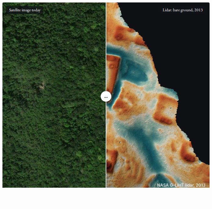
This screenshot demonstrates the contrast between traditional satellite photography and lidar technology described in the text.
While lidar data is increasingly used in archaeology, the sheer volume of data—covering thousands of square kilometers—makes manual human review labor-intensive and slow. The researcher chose to focus on the Maya region of Mexico due to its high level of public lidar coverage.
“They turned the lidar strips (about 1,200 km² of jungle) into images, and 48 agents went through them one by one like very patient archaeologists, looking for pyramids, platforms, and plazas while filtering out natural hills, sinkholes, and roads.”
— My AI Agents Found an Unmapped Maya Site
The Agentic Workflow
The methodology did not rely on a single specialized classifier. Instead, 48 autonomous agents were tasked with reviewing lidar strips one by one. They were instructed to follow a precise guide to identify man-made structures while filtering out natural features like sinkholes, roads, and hills.
After flagging several potential sites, the agents were tasked with cross-referencing these locations against existing literature and archives. They identified one specific hilltop on a cliff edge that appeared to have straight edges and sharp corners—features rarely found in nature—and confirmed it was not registered in known databases.
Verification and Official Response
To ensure the findings were not artifacts of the lidar processing, the agents analyzed raw point clouds. These 'slices' through the data showed that the ground (represented by brown dots) clearly traced the plaza and pyramid, while the vegetation (green dots) sat 10 to 17 meters above the structures.
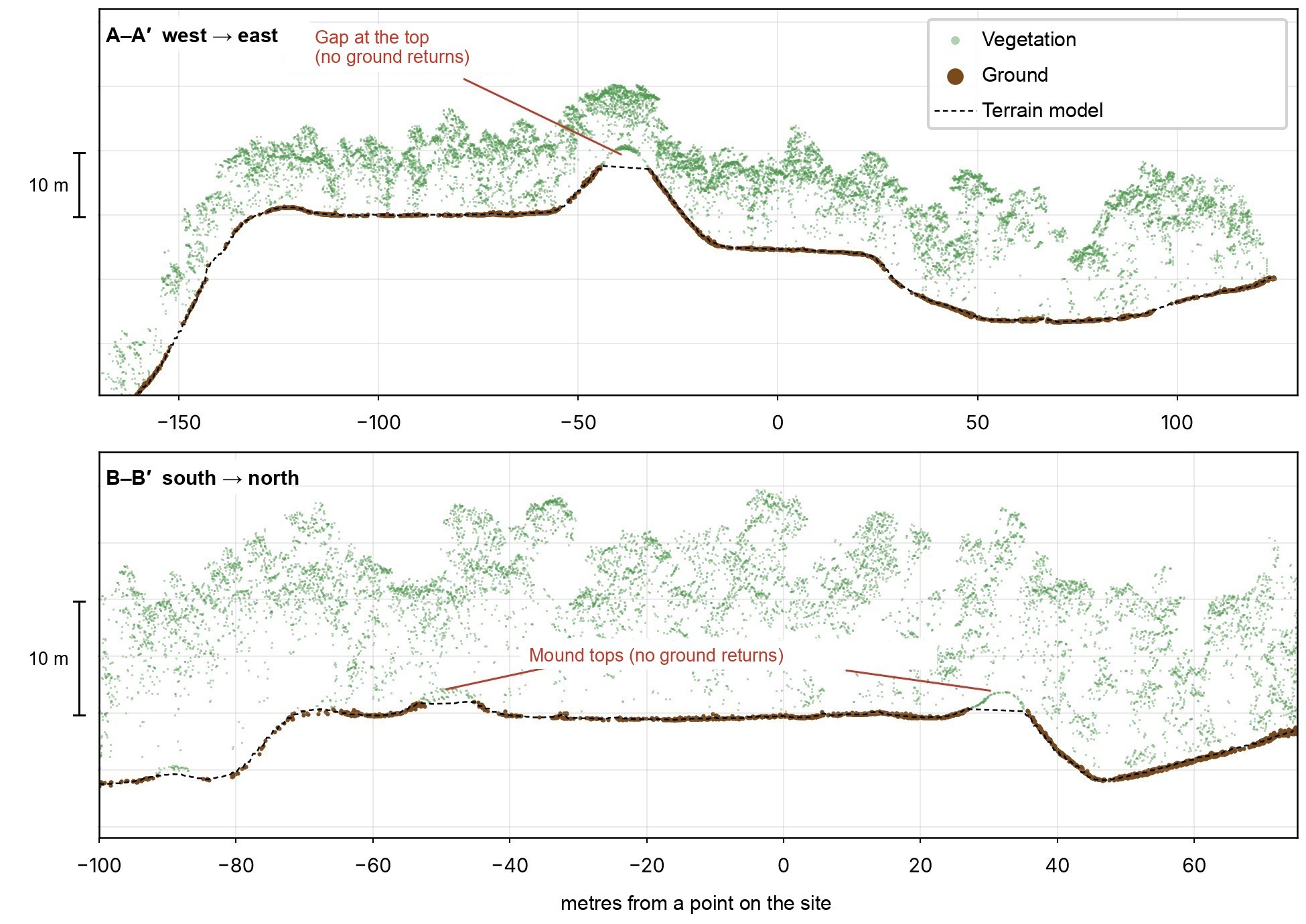
This visual supports the verification process where agents analyzed raw point clouds to separate ground features from trees.
The researcher submitted a formal report to INAH, which confirmed that no archaeological site was registered at the provided coordinates. While the discovery is not yet 'official' without a field expedition, the lidar data provides a high-confidence map of a civic center that includes a pyramid at least 8–12 meters tall.
Limitations and Next Steps
The current discovery remains a digital identification; it has not yet been physically verified by an archaeological team. The site's specific function remains speculative, though it is hypothesized to be a 'downtown' area for local elites during the Classic period.
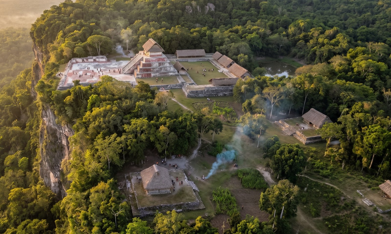
This reconstruction helps visualize the speculative 'downtown' function of the site mentioned in the limitations section.
The next phase involves a field check led by INAH. Because archaeological sites in Mexico are protected by federal law, any physical excavation or formal survey requires official authorization from the local center to deploy a team.
What Hacker News readers are saying
- Skeptical: One commenter expressed skepticism regarding the accuracy of the AI's findings, noting that autonomous agents can sometimes generate impressive but incorrect results that require verification by human experts. comment ↗
- Experience: A commenter raised concerns about the practical implications of rapid discovery, arguing that archaeologists may lack the capacity to protect and study numerous new sites before they are looted or damaged. comment ↗
- Skeptical: Another reader pointed out that the actual archaeological work will be a slow, methodical process and expressed interest in seeing if the AI's initial predictions align with physical evidence. comment ↗
Summarized opinions from the Hacker News thread, not verified facts. Read the full discussion ↗