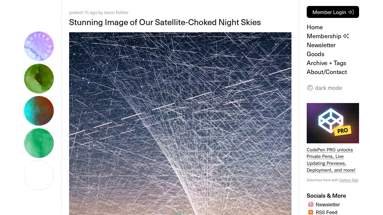
Photographer Brendan Larsen has released a composite image that visually captures the increasing density of satellites in our night skies. To create the work, Larsen spent two hours capturing 578 photographs of the sky over Mt Taranaki, using a camera set to take eight-second-long shots with a two-second gap between each. The resulting image reveals an estimated 14,450 satellite trail appearances, which represent approximately 1,400 individual satellites currently in orbit.
While the initial capture was straightforward, the post-processing required significant manual labor. Larsen spent approximately 45 hours in Adobe Photoshop layering the individual photos over one another. Because each photo contained roughly 25 satellites, the artist had to painstakingly mask and erase stars to reveal the satellite trails. This manual process was chosen to ensure the final image accurately represented the sheer volume of orbital activity, a method that distinguishes the work from AI-generated imagery or single long-exposure shots.
The image has sparked discussion regarding the visual representation of orbital density. Because the final product is a composite of hundreds of frames, some observers note that it may present a more saturated visual experience than a single traditional long-exposure photograph would capture. Despite this, the work highlights a permanent shift in the orbital environment, where the expansion of commercial and defense-related satellite constellations is rapidly changing the visibility of the night sky. The source does not specify the exact orbital paths or the regulatory permissions governing the placement of these specific satellites, leaving the precise distribution of these objects as an open question.