The OpenStreetMap Wiki maintains a dedicated category for North Korea that reveals the structured nature of mapping efforts for the country. This category, found at the OpenStreetMap Wiki, organizes resources related to mapping North Korea, including specific mapping pages, tagging guidelines, and satellite imagery.
The category contains specialized subcategories such as 'North Korean tagging guidelines' and mapping pages like 'Mapping North Korea' and 'North Korea Mapping Guide', available in both English and French (FR:Mapping North Korea, FR:North Korea Mapping Guide). These resources indicate a coordinated approach with clear documentation for mapping features specific to North Korea's geographic and infrastructural landscape. Additionally, the category includes media resources such as the 'Maxar Premium North Korea track image (circa 2021).png', providing contributors with recent satellite data to trace geographic features from afar.
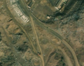
The image illustrates the satellite imagery resource mentioned in the OpenStreetMap Wiki category for North Korea, which contributors use to map geographic features.
Despite these resources, the category shows limitations: the 'Places in North Korea' subcategory is currently empty, suggesting a lack of detailed place-name data in the map. Furthermore, reliance on satellite imagery from circa 2021 may not capture recent changes on the ground, and the mapping effort remains dependent on remote sensing due to restricted physical access to certain areas, leaving some aspects of the map potentially incomplete or outdated.